Ambiente e paesaggio


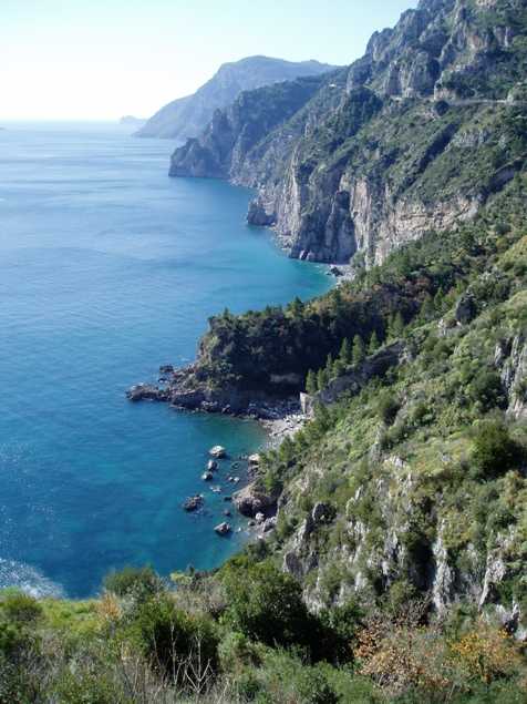
 Le risorse naturalistiche sono rappresentate dalla Selva di Santa Caterina, un bosco di due ettari, costituito soprattutto da castagni, accessibile dalla zona di Casa Nocillo e dai boschetti di pini e di lecci che si trovano in prossimità della Strada Statale Amalfitana n.163, in località Scaricatoio sullo specchio di mare che sovrasta gli isolotti de “ Li Galli”.
Translation by Ida Iaccarino

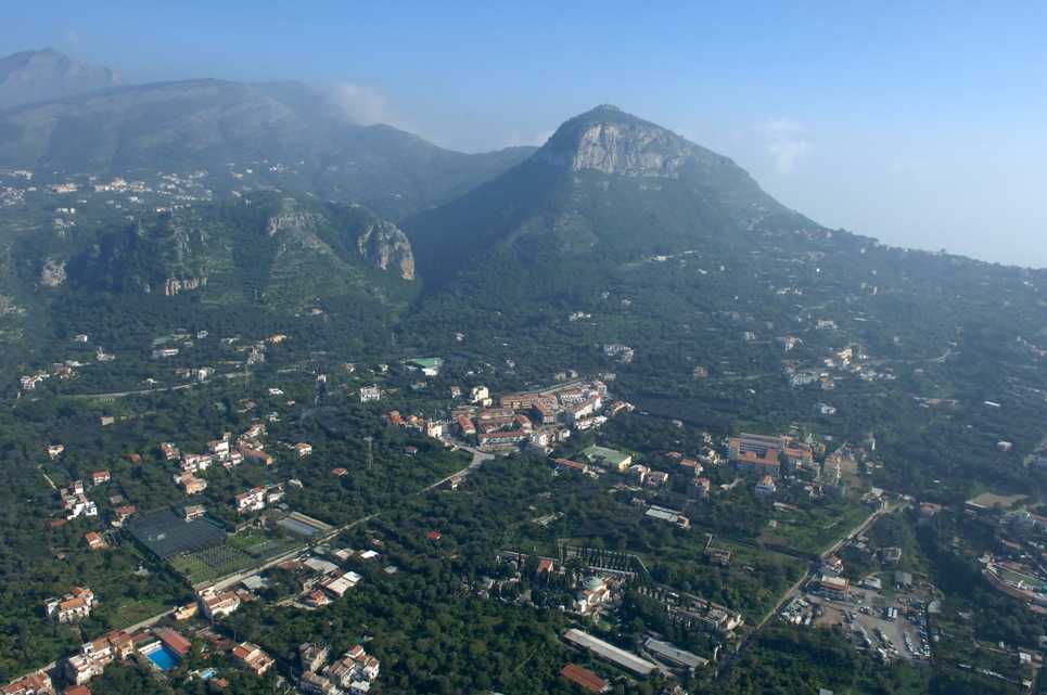
As its name testifies – “Piano” means “plain, flat land” - the whole municipality of Piano di Sorrento stretches along a plateau magically overlooking the sea and gently sloping down from the luxuriant hills which constitute its upper part.
Piano di Sorrento is situated in the central part of the Sorrentine Peninsula. As if by magic, Piano di Sorrento is a land located between the Amalfi Coast - in the south, overlooking the Gulf of Salerno - and the Sorrento Coast – in the north, overlooking the magnificent Gulf of Naples.
Piano di Sorrento is a natural terrace with a breathtaking view of the sea and the sleeping volcano Vesuvius in the background. On clear days, the diverse islands of the Gulf of Naples can be seen in the distance. On the other side there is the uncontaminated part of the coast overlooking the islands of Li Galli, as far as Positano. Last but not least, Monte Vico Alvano (Mount Vico Alvano) is worth mentioning. This “sentry” mountain - 643 metres high and particularly rich in vegetation - is the morphological emblem of this area. So, as you can see, the area of Piano di Sorrento is dominated by the sea and the mountains, giving life to an extremely varied scenery both for its colours and for its landscape.

The fishing village of Marina di Cassano is hidden between two tuff cliffs dropping sheer to the sea. This sea has slowly shaped the cliffs over time, near the sandy beach – which used to be different in the past. In this way, the sea gave the whole coast a natural charm, while the new tourist port will testify the maritime tradition of local heroes and seafarers. Unfortunately, the charm of the ancient shipbuilding industry will only remain in some dull old black and white photos.

The natural resources of Piano di Sorrento are embodied by the so-called Selva di Santa Caterina (Saint Catherine’s woods). These two-hectare woods are mainly constituted by chestnut trees and can be easily reached from the area of Casa Nocillo and from the pine and holmoak thickets situated near the Strada Statale Amalfitana n. 163 (Amalfi State Road n. 163) at “Scaricatoio” (which means “unloading area”), right above a stretch of sea overlooking the islets of “Li Galli”.


